


Product Information
This double-sided A1-sized map covers the entire iconic Fish River Canyon hike; and on the reverse the complete and fascinating geological map of the oldest canyon on Planet Earth matches the hiking map exactly. The map is printed on Duraflex waterproof material and is packaged in a plastic pocket.Data collected over four years has informed the content of this first-ever detailed topo map of the world-famous canyon. The map shows the suggested sides of the river to hike on, all the short-cuts, the usually-perennial pools, suggested overnight spots, etc etc. The maps includes distances both down the river and along the recommended route, as well as GPS coordinates, altitudes, etc
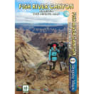
- A1+ full colour, double-sided map
- Scale 1:40 000 (2.5cm = 1km)
- 10m contours; relief shading
- 10" Long/Lat grid
- Coords in DDMMSS format at all recognised path junctions
- Contact numbers and detailed safety information
- WATERPROOF and TEAR RESISTANT in plastic wallet
Slingsby Fish River Canyon Hiking Map
1010803
This double-sided A1-sized map covers the entire iconic Fish River Canyon hike; and on the reverse the complete and fascinating geological map of the oldest canyon on Planet Earth matches the hiking map exactly. The map is printed on Duraflex waterproof material and is packaged in a plastic pocket.Data collected over four years has informed the content of this first-ever detailed topo map of the world-famous canyon. The map shows the suggested sides of the river to hike on, all the short-cuts, the usually-perennial pools, suggested overnight spots, etc etc. The maps includes distances both down the river and along the recommended route, as well as GPS coordinates, altitudes, etc
- A1+ full colour, double-sided map
- Scale 1:40 000 (2.5cm = 1km)
- 10m contours; relief shading
- 10" Long/Lat grid
- Coords in DDMMSS format at all recognised path junctions
- Contact numbers and detailed safety information
- WATERPROOF and TEAR RESISTANT in plastic wallet